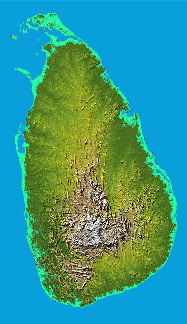
The south-central part of Sri Lanka--the rugged Central Highlands--is the heart of the country. The core of this area is a high plateau, running north-south for approximately sixty-five kilometers. This area includes some of Sri Lanka's highest mountains. (Pidurutalagala is the highest at 2,524 meters.) At the plateau's southern end, mountain ranges stretch 50 kilometers to the west toward Adams Peak (2,243 meters) and 50 kilometers to the east toward Namunakuli (2,036 meters). Flanking the high central ridges are two lower plateaus. On the west is the Hatton Plateau, a deeply dissected series of ridges sloping downward toward the north. On the east, the Uva Basin consists of rolling hills covered with grasses, traversed by some deep valleys and gorges. To the north, separated from the main body of mountains and plateaus by broad valleys, lies the Knuckles Massif: steep escarpments, deep gorges, and peaks rising to more than 1,800 meters. South of Adams Peak lie the parallel ridges of the Rakwana Hills, with several peaks over 1,400 meters. The land descends from the Central Highlands to a series of escarpments and ledges at 400 to 500 meters above sea level before sloping down toward the coastal plains.